top of page
3-img-As-Built Plans & Drawings.jpg

Building Survey Services


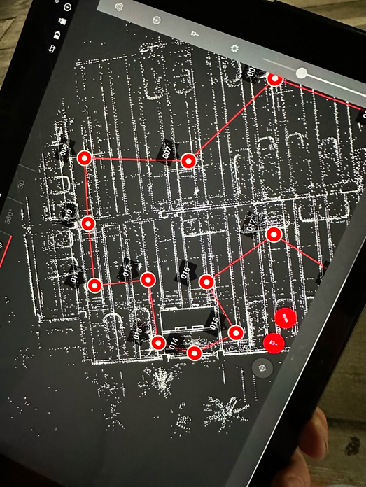
At DCMS, we specialize in accurate building surveys for architectural, engineering, and real estate needs. From site measurements to as-built documentation, our team delivers precise drawings, floor plans, and visual records using LiDAR, photogrammetry, and drone capture.
Whether you’re documenting a residential building, retail space, or institutional property, we provide reliable data in AutoCAD, PDF, or Revit — ready for planning, compliance, and execution.

Precision Building Surveys Tailored to Every Industry

DCMS delivers comprehensive building surveys and building site plans across the Americas.
 We support architects, interior designers, engineers, building owners, and retailers with surveys tailored to each project's needs — from real estate portfolios to permit sets.

Our work includes:

Civil Engineering Surveys

Retail and Mall Surveys

Residential and Interior Property Surveys

Institutional and School Surveys

Drone-based Key Maps & Aerial Photography

Redevelopment and building studies: accurate documentation with LiDAR, photogrammetry, and point-to-point laser to avoid rework and delays

Available in: AutoCAD, PDF, Excel Spreadsheets, and Revit.

1-img-As-Built Plans & Drawings.jpg
2-img-As-Built Plans & Drawings.jpg

Why Real Estate, Architecture & Engineering Firms Trust DCMS

Our building surveys support:

Permit sets, BOMA/REBNY area calculations, and as-built floor plans

Structural, mechanical, and architectural documentation workflows

What Sets DCMS Apart:

All scans performed by in-house specialists using LiDAR, drones, and point cloud capture

Data delivered in your preferred format: .dwg, .pdf, .rvt, or .xlsx

Arusted by design professionals across the Americas

1F0D734B-A029-4505-86CE-9F67BBB6227E_1_105_c 1.png

Power Your Project with Precision

Get reliable LiDAR data, 3D scans, and as-built documentation to move forward with accuracy and confidence.

Talk to a Specialist – Available Every Day, Anytime

Trusted by Leading Brands and Industry Leaders

DCMS As-Built Projects

Delivering verified accuracy across six industries.

image 230.jpg

ENGINEERING & INFRAESTRUCTURE

image 230.jpg

COMMERCIAL

FAQ
Fondo-web-DCMS_Service-2.jpg

Frequently asked questions

  • What is 3D scanning?
    3D scanning is a process of capturing three-dimensional data from an object using specialized equipment. The resulting point cloud data can be used to create highly accurate three-dimensional models of the object.
  • How is 3D scanning used for as-builts?
    3D scanning can be used to quickly and accurately capture existing conditions on a construction site. This data can then be used to create as-built drawings and models that can be used for future reference.
  • What are the benefits of using 3D scanning for as-builts?
    There are many benefits to using 3D scanning for as-builts, including the ability to create highly accurate documentation, capture data more quickly than traditional methods, and avoid disruptions to construction activities.
  • How much does 3D scanning cost?
    The cost of 3D scanning services can vary depending on the size and complexity of the project. However, in general, 3D scanning is more cost-effective than traditional methods of collecting as-built data.
  • How long does it take to scan a project?
    The time required to scan a project depends on the size and complexity of the project. However, in general, 3D scanning can be completed much more quickly than traditional methods of collecting as-built data.
  • How is the data collected?
    3D scanning services use specialized equipment to capture three-dimensional data from an object. This data is then converted into a point cloud that can be used to create highly accurate three-dimensional models.
  • What type of equipment is used for 3D scanning?
    There are many different types of equipment that can be used for 3D scanning. The type of equipment that is best suited for your project will depend on the size and complexity of the project.
  • How is the data processed?
    After the data is collected, it is converted into a point cloud that can be used to create highly accurate three-dimensional models. These models can then be used for future reference.
  • How long does it take to process the data?
    The time required to process the data depends on the size and complexity of the project. However, in general, 3D scanning can be completed much more quickly than traditional methods of collecting as-built data.
  • What are the deliverables?
    The final product of a 3D scanning project is a highly accurate three-dimensional model that can be used for future reference. This model can be used to create as-built drawings and documentation.
bottom of page