SHERMAN OAKS ENTRYWAY & HALL SURVEY
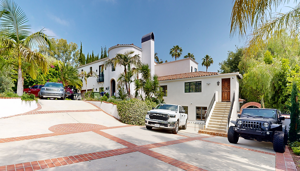
Sherman Oaks, California
1000 sq. ft.
Jun 02 – Jan 06 l 2025
As-Built Plans
Project Overview
Located in the hillside residential neighborhood of Sherman Oaks, this project focused on scanning a 1,000 sq. ft. portion of a multi-level private home. Known for its blend of contemporary and mid-century architecture, the area often features complex terrain and split-level designs factors that made accurate documentation critical. The scope included two circulation areas, specifically secondary entrances and hallways, which required detailed measurement for design planning and evaluation.
Deliverables
High-Resolution LiDAR Point Cloud: Accurate spatial data for as-built documentation
360° Digital Twin: Remote visualization tool for project stakeholders and designers
LOD 300 Revit Model: 3D Online Visualization Model & Views for design and coordination
AutoCAD Drawings & PDF Sheets – Fully annotated and coordinated documentation


Our Role & Technology
DCMS was tasked with delivering accurate spatial data to inform renovation plans for access points and circulation areas. By leveraging Matterport Pro3 technology, we ensured high-fidelity capture of the built environment.
Delivered a clean point cloud in RCP format, optimized for integration into Revit workflows
Captured precise dimensional data to support architectural design decisions
Focused on modeling exterior elevations and transitional areas with a high degree of geometric detail
Key Challenges & Solutions
Split-Level Terrain: The sloped lot introduced variations in elevation and entry points, requiring focused alignment of scan data
Access Variation: Each entrance had unique spatial characteristics; scanning ensured dimensional clarity for each front
Elevation Accuracy: Matterport’s scanning technology enabled reliable capture of height differentials and facade openings
OUR WORKFLOW:Scan, Process,
3D Modeling and Deliver


Kieran Morris
Project Manager at DSG Group
“DCMS responded quickly and delivered accurate survey documentation.”
From the first call to the on-site coordination, DCMS demonstrated efficiency and professionalism. Their team handled a focused 3D scan of two sides of the property with remarkable speed, ensuring minimal disruption. I served as the direct point of contact during the visit, which was seamless and well-organized.
