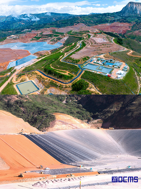
SHAHUINDO MINE
Cajamarca, Peru
Shahuindo S.A.C.
2021 - 2022
As-Built Plans
Project Overview
DCMS was contracted to support the monitoring of unauthorized mining activities in and around the Shahuindo Mine, using aerial photogrammetry and high-resolution orthophotos. Our mission was to detect illegal encroachments, land use changes, and informal mining operations, allowing site managers to enforce security protocols and plan risk mitigation strategies.
Deliverables
High density point cloud data.
Aerial Imagery Maps: For visual tracking of active and unauthorized zones
High-Resolution Orthophotos: Detecting new land movement and terrain alterations
3D Models of Terrain: Supporting analysis of volumetric changes and environmental monitoring


Our Role & Technology
Using drone-based photogrammetry workflows, DCMS delivered high-accuracy spatial data with minimal onsite disruption. Data was processed and integrated into geospatial systems to support mine safety, surveillance, and operational control. Tools Used:
Point cloud data processing.
Aerial photogrammetry for monitoring unauthorized mining activities,
DJI Phantom 4 RTK drone for high-accuracy imaging and mapping.
Key Challenges & Solutions
Visual monitoring of the mine’s area of influence with updated imagery.
Detection of topographic changes via comparative analysis
Orthomosaic maps and GIS-based reports for enhanced surveillance and decision-making
OUR WORKFLOW:Scan, Process,
3D Modeling and Deliver

Pan American Silver
Survey & Environmental
Compliance Team – Ancash, Peru
“Precise data that boosted operational and environmental planning”
DCMS delivered precise geospatial data that enhanced our operational and environmental planning. Their drone photogrammetry and surface models provided the clarity we needed to update base maps, monitor terrain, and calculate volumes confidently. Fast, reliable, and technically strong — a valuable partner on site.


