
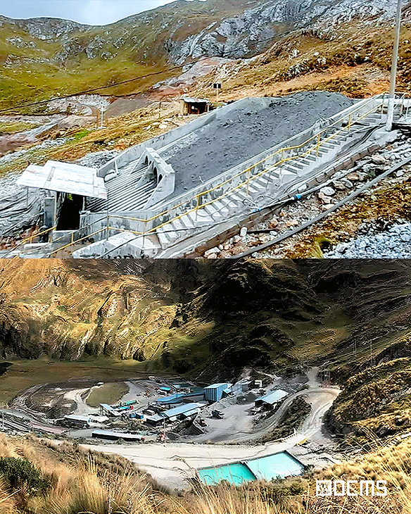
CONTONGA MINE
Ancash, Peru
Norcobre S.A.C.
Dec 2022
As-Built Plans
Project Overview
DCMS was commissioned to execute a comprehensive topographic and geospatial survey of a mining site in Ancash, Peru, aimed at updating the graphic base, supporting operational decisions, and monitoring environmental zones. Our team deployed drone photogrammetry and GNSS control points, capturing orthophotos and generating a digital surface model of the entire site.
Deliverables
Georeferenced Orthophotos: For terrain monitoring and planning
Digital Surface Model (DSM): Supporting topographic analysis
Volume Calculations: For stockpile and excavation planning
2D Base Map Update – For official documentation and compliance


Our Role & Technology
DCMS executed this project using GNSS surveying, UAV drone mapping, and high-accuracy photogrammetry workflows to create precise, large-scale spatial models. All data was processed and delivered as editable CAD/GIS outputs, compatible with regulatory and planning standards. Tools Used:
Topographic survey and base map update using WingtraOne GEN II drone, GNSS RTK,
Ground contro with Agisoft Metashape.
Processing witrh AutoCAD Civil 3D.
Key Challenges & Solutions
High-resolution orthophotos and accurate 3D surface models for terrain and volume analysis
Integration-ready data for GIS, AutoCAD, and mine planning tools
Enhanced environmental zone mapping and buffer analysis to support regulatory compliance and safe expansion
OUR WORKFLOW:Scan, Process,
3D Modeling and Deliver


NORCOBRE S.A.C.
Security & Environmental
Oversight Unit – Cajamarca, Peru
“DCMS helped us monitor land changes and illegal mining precisely”
Their aerial imagery and point cloud data allowed us to track encroachments, terrain shifts, and informal activity across a vast area — essential for enforcing site security and planning mitigation strategies. Their team was fast, responsive, and technically sharp throughout.
