SHERMAN OAKS ENTRYWAY & HALL SURVEY
Sherman Oaks, California
1000 sq. ft.
Jun 02 – Jan 06 l 2025
As-Built Plans
Aperçu du projet
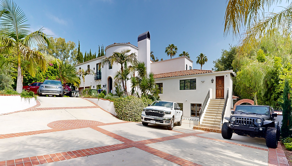
Located in the hillside residential neighborhood of Sherman Oaks, this project focused on scanning a 1,000 sq. ft. portion of a multi-level private home. Known for its blend of contemporary and mid-century architecture, the area often features complex terrain and split-level designs factors that made accurate documentation critical. The scope included two circulation areas, specifically secondary entrances and hallways, which required detailed measurement for design planning and evaluation.
Livrables
High-Resolution LiDAR Point Cloud: Accurate spatial data for as-built documentation
360° Digital Twin: Remote visualization tool for project stakeholders and designers
LOD 300 Revit Model: 3D Online Visualization Model & Views for design and coordination
AutoCAD Drawings & PDF Sheets – Fully annotated and coordinated documentation


Notre rôle et notre technologie
DCMS was tasked with delivering accurate spatial data to inform renovation plans for access points and circulation areas. By leveraging Matterport Pro3 technology, we ensured high-fidelity capture of the built environment.
Delivered a clean point cloud in RCP format, optimized for integration into Revit workflows
Captured precise dimensional data to support architectural design decisions
Focused on modeling exterior elevations and transitional areas with a high degree of geometric detail
Principaux défis et solutions
Split-Level Terrain: The sloped lot introduced variations in elevation and entry points, requiring focused alignment of scan data
Access Variation: Each entrance had unique spatial characteristics; scanning ensured dimensional clarity for each front
Elevation Accuracy: Matterport’s scanning technology enabled reliable capture of height differentials and facade openings
NOTRE FLUX DE TRAVAIL : Numériser, Traiter,
Modélisation et livraison 3D


Kieran Morris
Project Manager at DSG Group
“DCMS responded quickly and delivered accurate survey documentation.”
From the first call to the on-site coordination, DCMS demonstrated efficiency and professionalism. Their team handled a focused 3D scan of two sides of the property with remarkable speed, ensuring minimal disruption. I served as the direct point of contact during the visit, which was seamless and well-organized.

Dynamisez votre projet avec précision
Obtenez des données LiDAR fiables, des numérisations 3D et une documentation conforme à l'exécution pour avancer avec précision et confiance.
Parlez à un spécialiste – Disponible tous les jours, à tout moment
Approuvé par les plus grandes marques et les leaders de l'industrie