
MINE DE CONTONGA
Ancash, Pérou
Norcobre S.A.C.
Déc 2022
As-Built Plans
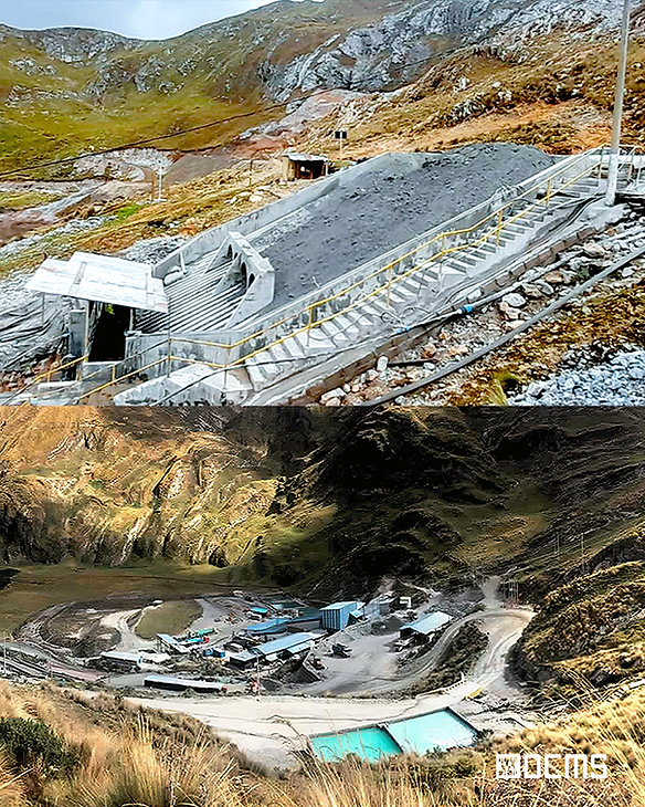
Aperçu du projet
DCMS a été chargé de réaliser un levé topographique et géospatial complet d'un site minier à Ancash, au Pérou, afin de mettre à jour la base graphique, d'appuyer les décisions opérationnelles et de surveiller les zones environnementales. Notre équipe a déployé des moyens de photogrammétrie par drone et des points de contrôle GNSS, capturant des orthophotographies et générant un modèle numérique de surface de l'ensemble du site.
Livrables
Orthophotos géoréférencées : pour la surveillance et la planification du terrain
Modèle numérique de surface (MNS) : prise en charge de l'analyse topographique
Calculs de volume : pour la planification des stocks et des excavations
Mise à jour de la carte de base 2D – Pour la documentation officielle et la conformité


Notre rôle et notre technologie
Le DCMS a réalisé ce projet en utilisant des méthodes de topographie GNSS, de cartographie par drone et de photogrammétrie de haute précision pour créer des modèles spatiaux précis à grande échelle. Toutes les données ont été traitées et livrées sous forme de fichiers CAO/SIG modifiables, compatibles avec les normes réglementaires et d'urbanisme. Outils utilisés :
Relevé topographique et mise à jour de la carte de base à l'aide du drone WingtraOne GEN II, GNSS RTK,
Contrôle au sol avec Agisoft Metashape.
Traitement avec AutoCAD Civil 3D.
Principaux défis et solutions
Orthophotographies haute résolution et modèles de surface 3D précis pour l'analyse du terrain et du volume
Données prêtes à être intégrées pour les SIG, AutoCAD et les outils de planification minière
Cartographie améliorée des zones environnementales et analyse des zones tampons pour soutenir la conformité réglementaire et une expansion sûre
NOTRE FLUX DE TRAVAIL : Numériser, Traiter,
Modélisation et livraison 3D


Argent panaméricain
Unité de surveillance de la sécurité et de l'environnement – Cajamarca, Pérou
“ Le DCMS nous a aidé à surveiller avec précision les changements fonciers et l'exploitation minière illégale ”
Leurs images aériennes et leurs données de nuages de points nous ont permis de suivre les empiètements, les variations de terrain et les activités informelles sur une vaste zone, ce qui est essentiel pour assurer la sécurité du site et planifier des stratégies d'atténuation. Leur équipe a fait preuve de réactivité, de réactivité et d'une expertise technique pointue tout au long du processus.

Dynamisez votre projet avec précision
Obtenez des données LiDAR fiables, des numérisations 3D et une documentation conforme à l'exécution pour avancer avec précision et confiance.
Parlez à un spécialiste – Disponible tous les jours, à tout moment
Approuvé par les plus grandes marques et les leaders de l'industrie